From a whole license to a ranked list of drill targets in weeks, not seasons.
Terraprisma compiles everything known about your ground, fuses it with satellite, radar and hyperspectral data, and turns it into ranked, interpreted targets remotely, before a single boot hits the ground.
From a whole license to a ranked list of drill targets in weeks, not seasons.
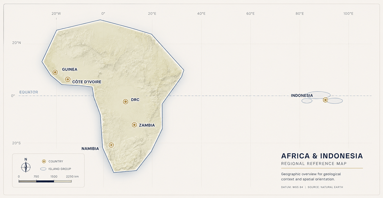
Terraprisma works wherever there’s ground to assess fully remotely. Below: an anonymized footprint of delivered and active projects. Client identities stay confidential.
6
Countries
2
Continents
100%
Remote delivery
5,000+
km² per study
ESA BIC Noordwijk
Google Cloud for Startups
Microsoft for Startups
Mining Indaba 2025 panelist
ESA BIC Noordwijk
Google Cloud for Startups
Microsoft for Startups
Mining Indaba 2025 panelist
The deliverable
What you actually get.
Not raw imagery a decision you can act on, the file to support it, and the data behind it if you want to check our work.
Ranked, interpreted targets
A shortlist of zones, ordered by prospectivity each interpreted by our geologists, with the reasoning behind it.
Decision-ready report
A technical report plus GIS- ready layers that drop straight into your workflow and your investor materials.
Full dataroom access
Every layer, every input, every step open for your team to inspect and re-run the logic. Nothing is a black box.
ESG baseline included
A 10-year environmental baseline for your area, ready for permitting and due diligence from day one.
The method
How it works.
We start where good exploration always does with everything already known about the ground.
01 / COMPILE
We gather what's known
Literature, historical exploration data, public geological and geophysical datasets compiled to define the mineral system we’re looking for.
02 / FUSE
We add the satellite layer
Multispectral, hyperspectral, radar/SAR and terrain, fused with the known geology into one analysis-ready data cube.
03 / INTERPRET
AI + geologists read the signal
Models detect anomalies and map structures; our geologists interpret them against the defined system into ranked targets.
04 / DELIVER
You get a decision
A ranked targeting report and GIS layers plus dataroom access to inspect every layer behind it.
The method
For teams deciding where to focus next.
Whatever the stage, the question is the same: which ground earns the next field budget?
Greenfield
Juniors with a new license
A large, under-explored area and pressure to find drill targets fast before the season and the budget run out.
Brownfield
Operations looking to expand
A known or producing asset, hunting the next zone and extending the system without a full new campaign.
Portfolio
Mid-tiers & majors
Several licenses to triage at once deciding which ground deserves fieldwork and which can wait.
With or without an in-house geology team. We always deliver fully interpreted targets you don’t need geologists on staff to use the result. And teams that do have their own geologists get full dataroom access to re-check the work and re-run the logic themselves.
“Exploration teams don’t need more data they need a defensible decision about where to look first. Everything we build serves that one call.”
Thomas Kaakeh Exploration Geologist & CEO, Terraprisma